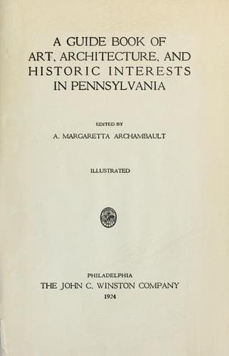
A guide book of art, architecture, and historic interests in Pennsylvania
History
A guide book of art, architecture, and historic interests in Pennsylvania
Architecture -- Pennsylvania; Art -- Pennsylvania; Historic buildings -- Pennsylvania; Pennsylvania -- Guidebooks; Pennsylvania -- History
Formed March 2, 1831; name, from the Juniata River, was given by the
original people who lived in this region, and who were obliterated by
the Iroquois; root of word means “a stone.” “Standing Stone” may be
regarded as translation of “Onojutta-Haga” or the Juniata people. A
mountainous country with many fertile valleys, situated between the
Tuscarora and Blue Ridge Mountains, famous for its scenery, with the
blue Juniata making a wide sweep. The old Pennsylvania canal followed
its banks throughout its whole course. First settlers were mostly
Scotch-Irish.
The old homestead of Francis Innis, one and a half stories, stone, east
of McCoysville, is still in possession of descendants, now used as a
spring house; his two children, captured by the Indians, were recovered
among those delivered to Colonel Bouquet in 1764. Another old landmark,
eight miles away, is the D. B. Esh house, on east Waterford Road, built
by Mr. Graham in 1802; has an open stairway carved by hand. First road
laid out in 1768, was from Sherman’s Valley to Kishecoquelas Valley. The
historic road between Harrisburg and Pittsburgh, through the famous
Jack’s Narrows, over which stage coaches traveled, is now part of the
William Penn Highway. Sites of Forts Bingham and Patterson will soon be
marked by the General Thomas Mifflin Chapter,
[Illustration: JUNIATA COUNTY]
Daughters of the American Revolution. Chief industries, agriculture and
manufactories.
MIFFLINTOWN, county seat, population 1083, joined with its twin borough,
MIFFLIN, on Pennsylvania Railroad main line, by bridge over the Juniata,
was laid out in 1791 by John Harris, and named in honor of the governor
of the state, General Mifflin. Courthouse in center of town on Main
Street, built, 1874, brick, Georgian, with Ionic porch and cupola; in
the yard is a monument, surmounted by a spread eagle, to Civil War
soldiers from Juniata County, erected in 1870. The churches are of good
architecture, and the graded high school is said to be the best between
Harrisburg and Huntingdon.
[Illustration: MONROE COUNTY]
LIII
MONROE COUNTY
Formed April 1, 1836; named in honor of President James Monroe. The
Pocono Mountains and long, fertile valleys cover the surface. Chief
industries, farming, lumber, and manufacturing. In the southeast, where
the Delaware River turns suddenly at Mount Kittatinny, towering 1600
feet above it, is the Delaware Water Gap, with views of great distance
from the highest point; near are the Wind Gap and Smith’s Gap; William
Penn’s famous Walking Land Purchase ended near here. The Milford Road,
laid out about 1800, from Easton, leaves Delaware River at Water Gap
village, thence four miles to Stroudsburg, then to Bushkill and beyond.
Public-domain text, read in full here on John Shaqi.
Reviews
Reviews
No reviews yet
Be the first to share your thoughts on this work.
Elsewhere in the archive
Join the Discussion
Join the discussion
Sign in to leave a comment or review.
Sign InorCreate an account