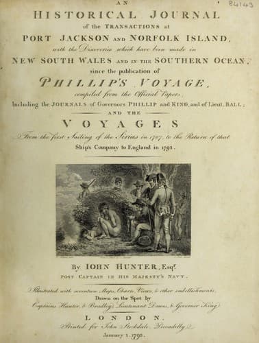
An Historical Journal of the Transactions at Port Jackson and Norfolk IslandHunter, John
History
An Historical Journal of the Transactions at Port Jackson and Norfolk Island
Hunter, John
New South Wales -- History -- Sources
On the 18th, at eight o'clock in the morning, we saw three
small islands bearing west-north-west, and very high land bearing
south-west: at eleven o'clock two more islands were in sight from
the mast-head, and two smaller ones, which appeared no larger
than rocks: at noon five islands and two rocks were to be seen;
they seemed all to be connected by a reef which on the west side
extended some distance from them; great part of a sand bank
within the reef appeared dry, and some natives were seen upon it;
two canoes, with triangular sails, endeavoured to reach the ship,
but it blew very fresh, and we could not afford to lose time.
These I took to be a part of Captain Carteret's nine islands;
they seemed to lie in the direction of south-east and
north-west.
We sailed round the south end, from which, to the westward, a
reef extends about two miles. The southermost island lies in the
latitude of 4 53' south, and longitude 155 deg. 20' east; the
south-westernmost island is in 4 deg. 50' south, and longitude
155 deg. 13' east. The land seen in the south-west was
exceedingly high, and bore at noon south-south-west half west: at
sun-set, the extremes of the high land bore from south by east to
west-south-west, and seemed to terminate to the northward in a
low woody point; about the middle part of this high land there is
a considerable breach or opening, which had much the appearance
of a streight or passage through; and as I judge this is the
land, along the west side of which Lieutenant Shortland, in the
Alexander transport, sailed, until he found an opening through
which he passed to the eastward, I think it highly probable that
this may be the streight; particularly as he says, "That soon
after he was clear, and stretching to the north-east, he fell in
with four islands, which he took to be part of Carteret's nine
islands*." This opening was intersected from two stations, and
the run of the ship, and was found to lie in the latitude of
5 deg. 25' south, and longitude 154 deg. 30' east.
[* See Shortland's Journal and Charts in Phillip's
Voyage, fourth Edition; and "Discoveries of the French," by M.
Fleurieu, late minister of the French Navy: a very ingenious and
able work on the discoveries of the French and Spaniards in the
South Seas.]
Whether these islands, which I have last mentioned are Captain
Carteret's nine islands, or those Lieutenant Shortland saw, I
will not be very positive; he says, they extended north-west by
west and south-east by east; the direction is nearly the same,
and the distance in that direction is fifteen leagues, and their
number nine. We did not see much more than half that distance, in
which seven only were to be seen.
Our latitude, considering that he passed round the north end,
and we the south, will agree very well; and with respect to
longitude, his was determined by the reckoning of the ship, mine
by lunar observations, and the difference is only about a
degree.
Public-domain text, read in full here on John Shaqi.
Reviews
Reviews
No reviews yet
Be the first to share your thoughts on this work.
Elsewhere in the archive
Join the Discussion
Join the discussion
Sign in to leave a comment or review.
Sign InorCreate an account