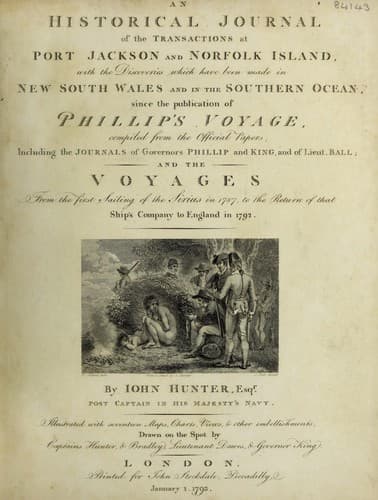
An Historical Journal of the Transactions at Port Jackson and Norfolk IslandHunter, John
History
An Historical Journal of the Transactions at Port Jackson and Norfolk Island
Hunter, John
New South Wales -- History -- Sources
Their canoes appeared from forty to fifty feet long, were
neatly made, and turned a little up at the extremities; there was
a stage which lay across the midships of the boat, and projected
out some distance on one side; it was bent upwards a little at
the outer end, to prevent its dipping in the water, by the motion
of the boat; this stage seemed intended for the warriors to use
their weapons upon: on the opposite side, was fitted in a
different manner, an out-rigger to balance the boat; three of the
rowers sat before and three abaft the stage, so that those
intended for battle were not at all incommoded by them.
A heavy black squall coming on at this time, they all pushed
for the land, otherwise I believe we might have prevailed on them
to come alongside.
The north-west end of this island is in latitude 2 deg. 21'
south; longitude 147 deg. 28' east; and the southermost point in
sight was in latitude 2 deg. 28' south, and longitude 147 deg.
33' east. A fresh breeze now sprung up, and we wished if possible
to clear the islands before night: all sail was made, and as we
ran past this large island, we raised many others; in short, land
was seen in every direction; four islands were seen from the
mast-head, bearing east-north-east, and two low level islands
a-head, between which there appeared an open passage; we steered
for it, and at noon passed through it: its latitude is 2 deg. 10'
south; longitude 147 deg. 26' east.
At four in the afternoon, the western extremity of a very long
island bore west half south, and we steered west-north-west,
determined to run no farther during the night than we could see
before dark. The night was very dark, with heavy rain, and a very
light air of wind.
At day-light the extremity of a very large island, bore from
south-east to south-west by south; at noon the latitude observed
was 1 deg. 44' south, and the extremes of this island, as far as
the eye could reach, bore from south 23 deg. 00' east, to south
50 deg. 00' west, distant from the nearest shore five leagues.
This island is so very extensive, that I believe it to be the
largest of the Admiralty Islands: I do not think that we saw its
western extremity, for as far as we could discern from aloft,
trees were to be seen just above the horizon: the westermost
point seen from the ship was in latitude 1 deg. 59' south, and
the longitude of it was 146 deg. 30' east.
This groupe of islands is very extensive, as well in a north
and south direction as east and west. Having now got to the
westward of the Admiralty Islands, I considered myself clear of
St. George's Channel; and I agree perfectly with Captain
Carteret, in thinking it a very safe, and (to ships bound
northward, which want water,) a very convenient navigation; his
chart was of much use to us in coming through, although, had time
permitted, considerable additions, and some improvements, might
have been made to it.
Public-domain text, read in full here on John Shaqi.
Reviews
Reviews
No reviews yet
Be the first to share your thoughts on this work.
Elsewhere in the archive
Join the Discussion
Join the discussion
Sign in to leave a comment or review.
Sign InorCreate an account