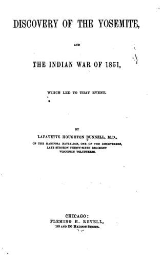
Discovery of the Yosemite, and the Indian War of 1851, Which Led to That EventBunnell, Lafayette Houghton
History
Discovery of the Yosemite, and the Indian War of 1851, Which Led to That Event
Bunnell, Lafayette Houghton
Indians of North America -- California; Pacific Coast Indians, Wars with, 1847-1865; Yosemite Valley (Calif.)
Upon riding over to the camp ground the next morning, it was found that
the body had been carried up or secreted in Indian Cañon; as all of
the tracks led that way. This ravine became known to _us_ as “Indian
Cañon,” though called by the Indians “Le-Hamite,” “the arrow wood.” It
was also known to them by the name of “Scho-tal-lo-wi,” meaning the
way to “_Fall Creek_.” The rocks near which we were encamped, between
“Indian Cañon” and “The Falls,” were now called by the Po-ho-no-chee
scouts who were with us, “Hammo” or “Ummo” “The Lost Arrow,” in
commemoration of the event. On the morning following the capture of
Ten-ie-ya, Capt. Boling tried to have a talk with him; but he would not
reply to a question asked through the interpreter; neither would he
converse with Sandino or the Indians with us. He maintained this moody
silence and extreme taciturnity for several days afterwards.
Finding that nothing could be accomplished through the old chief,
Captain Boling gave orders to re-commence our search for his people.
Scouting parties were started on foot to explore as far as was
practicable on account of the snow. Although it was now May, the snow
prevented a very extended search in the higher Sierras. On the first
day out these parties found that, although they had made a faithful and
active search, they had not performed half they had planned to do when
starting. Distances were invariably under-estimated. This we afterward
found was the case in all of our excursions in the mountains, where we
estimated distance by the eye; and calling attention to the phenomena,
I tried to have the principle applied to heights as well. The height of
the mountainous cliffs, and the clear atmosphere made objects appear
near, but the time taken to reach them convinced us that our eyes had
deceived us in our judgment of distance. To avoid the severe labor
that was imposed upon us by carrying our provisions and blankets, an
attempt was made to use pack-mules, but the circuitous route we were
compelled to take consumed too much time; besides the ground we were
desirous of going over was either too soft and yielding, or too rocky
and precipitous. We were compelled to leave the mules and continue our
explorations on foot. Later in the season there would have been no
difficulty in exploring the mountains on horse-back, if certain well
established routes and passes were kept in view; but aside from these
our Indian guides could give us little or no information. This we
accounted for upon the theory that, as there was no game of consequence
in the higher Sierras, and the cold was great as compared with the
lower altitudes, the Indians knowledge of the “Higher Sierras” was
only acquired while passing over them, or while concealed in them from
the pursuit of their enemies. All scouting parties were, therefore,
principally dependent upon their own resources, and took with them
a supply of food and their blankets for a bivouac. In this way much
Public-domain text, read in full here on John Shaqi.
Reviews
Reviews
No reviews yet
Be the first to share your thoughts on this work.
Elsewhere in the archive
Join the Discussion
Join the discussion
Sign in to leave a comment or review.
Sign InorCreate an account