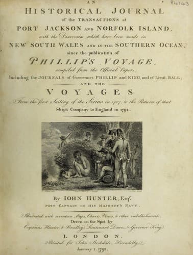
An Historical Journal of the Transactions at Port Jackson and Norfolk IslandHunter, John
History
An Historical Journal of the Transactions at Port Jackson and Norfolk Island
Hunter, John
New South Wales -- History -- Sources
As I have spent so much time upon an island, which has of late
been much spoken of, and of which many flattering accounts seem
to have been given, it will be expected that I should say
something concerning it.
NORFOLK ISLAND.
Mount Pitt, or the highest land, lies in Latitude 29 deg. 02'
south. Longitude 168 deg. 05' east of the meridian of Greenwich.
Ships, on making Norfolk Island*, may stand boldly in, there
not being any thing farther out than half a mile from the shore
to take them up. If the wind is west to south or south-east,
there is generally too much surf in Sydney-Bay for boats to land,
which circumstance is signified from the shore by not hoisting
any flag at the lower flag-staff; in which case you will
generally find good landing in Cascade-Bay, where I think there
would not be any difficulty in landing provisions from a
ship.
[* The remarks and directions for Norfolk Island and
Sydney-Bay were made by Captain Bradley.]
If she should put in here, she might always be getting her
cargo out either there or at Sydney-Bay, as the winds that
prevent landing in Cascade-Bay generally make smooth water in
Sydney-Bay. People may at times be landed in Ball-Bay,
Duncombe-Bay, and Anson's-Bay, but neither stores nor provisions
can be landed, on account of the perpendicular hills that
surround them. The ground of the north side of the island is
clearer of rocks than in Sydney-Bay.
Great attention should be paid to the tides, and on the south
side of the island particularly; with southerly and south-east
winds I have known the tide shift six points, at different times,
in the space of half an hour; and if you cannot lie up
south-south-west, standing off upon the larboard tack, the ebb
tide will heave you in upon the shore. There is a mud bank to the
north-east by north of Nepean's island, where a ship might safely
anchor in westerly winds, and prevent being driven off Norfolk
Island.
SYDNEY BAY*,
Lies in latitude 29 deg. 05' south; longitude 168 deg. 02'
east; and variation 11 deg. 00' east. The tide flows full, and
changes at three quarters past seven, and rises from five to
seven feet: the flood runs to the south-west by south; and the
ebb to the north-east by north.
[* For Sydney-Bay, Norfolk Island, upon a large
scale, see Phillip's Voyage.]
In general the tides are equal each way, the ebbs and the
flows regular along the shore six each tide: the eastern tide is
stronger than the western tide; sometimes the eastern tide runs
several hours beyond its usual course, and sometimes the western
tide thus irregularly, which irregularities, although they seldom
happen, make it necessary to bring to, and try the tide before
you come within the outer part of the Nepean Island; and be aware
of an indraught, which sometimes sets into the bight on the west
side of the bay, on both tides, while you are baffled by the
south-east and southerly winds, as you come in with
Sydney-Bay.
Public-domain text, read in full here on John Shaqi.
Reviews
Reviews
No reviews yet
Be the first to share your thoughts on this work.
Elsewhere in the archive
Join the Discussion
Join the discussion
Sign in to leave a comment or review.
Sign InorCreate an account