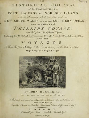
An Historical Journal of the Transactions at Port Jackson and Norfolk IslandHunter, John
History
An Historical Journal of the Transactions at Port Jackson and Norfolk Island
Hunter, John
New South Wales -- History -- Sources
These islands, when we first discovered them, appeared as only
one, which induced me to think it might be Carteret's Island; and
had it not been that by going nearer we discovered that there
were five of them, and that they did not at all answer the
description of that given by Captain Carteret, I should have
concluded that it was so, although the longitude of his island
must have been very erroneous, had it been the case. Their
latitude is 8 deg. 26' south, which is nearly the latitude of
Carteret's; and their longitude, deduced from the preceding day's
observations, is 163 deg. 18' east. We steered from them directly
to the northward, in order to see if we could discover Gower's
Island, which Captain Carteret says lies about ten or eleven
leagues to the northward of Carteret's; but as we saw nothing, I
concluded they had never been seen before; I therefore called
them Stewart's Islands, as a mark of my respect for the
honourable Keith Stewart.
The two largest of the islands just mentioned I judged to be
about three miles in length; whether they were inhabited or not
we could not discover: we passed to windward of them, and not
being situated conveniently for making discoveries, or exploring
unknown lands, we made the best of our way to the northward: just
after we left these islands, we passed through a very strong
ripling of a tide or current, and saw the trunks of several large
trees in the water. On the 12th, at nine o'clock in the morning,
the man at the mast-head discovered breakers on the starboard
bow, and not more than six miles distant; soon after, breakers
were seen on the starboard quarter, and on the beam, extending in
the direction of east-south-east and west-north-west five leagues
distant: at eleven, breakers were seen on the larboard beam, in
different patches about two miles long, and lying parallel to
those on the starboard side.
On this we brought to, and sounded with 130 fathoms of line,
but had no ground. This had the appearance of a dangerous cluster
of shoals, for being situated in a climate where it seldom blows
so strong as to raise a large sea, a ship might in the night,
without a very good look-out, be in very great danger before they
could be perceived: they appeared to be sand shoals, and very
little below the surface: the passage we sailed through is in
latitude 6 deg. 52' south, and longitude 161 deg. 06' east: these
patches should not be crossed in the night: I called them
Bradley's Shoals. The variation was here 8 deg. 01' east.
Public-domain text, read in full here on John Shaqi.
Reviews
Reviews
No reviews yet
Be the first to share your thoughts on this work.
Elsewhere in the archive
Join the Discussion
Join the discussion
Sign in to leave a comment or review.
Sign InorCreate an account