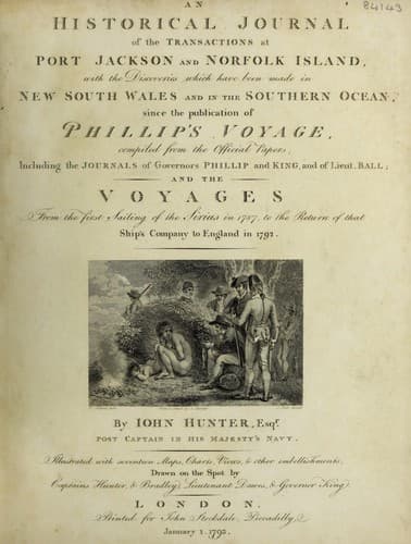
An Historical Journal of the Transactions at Port Jackson and Norfolk IslandHunter, John
History
An Historical Journal of the Transactions at Port Jackson and Norfolk Island
Hunter, John
New South Wales -- History -- Sources
On the 27th in the morning, we prepared for sailing; before we
got under way, two English pointers, male and female, which had
been given to the master of the ship at Port Jackson, were sent
on shore, and given to a party of the natives, who seemed highly
delighted with them; a cock and hen were also given to them.
At ten o'clock we sailed out of the bay. This bay was named
Port Hunter; its latitude is 4 deg. 7' 30" south, and longitude
152 deg. 42' east; although it is not large, it is convenient and
safe at this season; it lies on the north-west part of the
island, and you may anchor in any part of it, from twenty-five to
fifteen fathoms, but the shoal-water has the worst ground: in
twenty fathoms it is soft, with loose patches of coral; the
watering place is on the east side, but as the tide flows up to
the place from whence the fresh water issues, it is best to fill
from half ebb to half flood. The water is so exceedingly soft,
that there were some amongst us who were so prejudiced against it
that they believed it brackish; a quality I own which I never
could discover in it; I was therefore of opinion that this
prejudice could only have proceeded from knowing that the salt
water was so very near it at high water time; such opinions were
not however confirmed from experience, as we never felt any
inconvenience from it. The tide here seemed to rise five or six
feet, but the exact period of high water was not noticed, we had
so much business to do.
We steered north-west by west, and west-north-west, and at
eight o'clock in the morning, saw Sandwich Island, bearing
north-west; at noon, our latitude was 3 deg. 13' south, and
longitude 150 deg. 42' east; the south-west point of Sandwich
Island bearing north 45 deg. west, distant from the nearest shore
six leagues. The latitude of the south-west point will be 2 deg.
58' south, and its longitude 150 deg. 27' east. This island is of
moderate height, and well covered with wood; we passed on the
south side; its general direction is about east-north-east and
west-south-west, and in that direction is about seven leagues in
length: it appeared to be of considerable breadth at its eastern
end, and narrow towards its western, where it terminates in a
narrow point, off which lies a small woody island, with a narrow
passage between that and the main island, to which it appears
connected by a reef. On the north side of Sandwich Island, we
observed the remarkable peaked hill mentioned by Captain
Carteret, and also the corresponding one on the coast of New
Ireland.
Public-domain text, read in full here on John Shaqi.
Reviews
Reviews
No reviews yet
Be the first to share your thoughts on this work.
Elsewhere in the archive
Join the Discussion
Join the discussion
Sign in to leave a comment or review.
Sign InorCreate an account