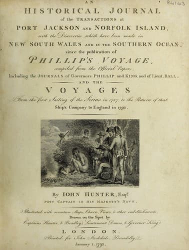
An Historical Journal of the Transactions at Port Jackson and Norfolk IslandHunter, John
History
An Historical Journal of the Transactions at Port Jackson and Norfolk Island
Hunter, John
New South Wales -- History -- Sources
On the 14th in the morning, we saw land bearing north; this we
found to be two islands joined together, or nearly so, by a long
sandy spit, above water, which reached for about two-thirds of
the distance from the eastermost or largest island, to the
westmost, which is small. All round the largest is a sand-bank
above water, which extends from the foot of the higher land about
half a mile into the sea, and may have shoal water from it. We
saw on the beach a few natives running along shore, as the ship
sailed past. These islands are dangerous to people in the night,
on account of the sandy spits which project from them; they were
covered with shrubs, and had but few tall trees on them, and the
land is but low: the latitude of the large or eastmost island, is
8 deg. 06' north, and longitude 140 deg. 03' east. I did at first
suppose them to have been part of the New Carolines, but they
seem to lie quite alone, and are about five miles asunder. I
called them Phillip Islands, after Arthur Phillip, the governor
of New South Wales.
On the 17th of July in the morning, we saw land from the
mast-head, bearing west by south nine or ten leagues distant; at
noon we could see it from the deck, and it appeared to be three
islands; at four in the afternoon, they bore south by west
three-quarters west, and were by intersections taken from the
ship, distant eight leagues. A considerable number of fish being
at that time round the ship, the people, in looking over the side
at them, discovered rocks under the bottom; we immediately
sounded, and had fifteen fathoms: the rocks appeared very large,
with patches of white sand between them; in twenty minutes, the
water appeared to deepen, and we had no ground with forty fathoms
of line. This ridge of rocks appeared to be about half a mile in
breadth, and was seen from the mast-head to stretch to the
southward towards the islands, and considerably to the northward
of the ship; although it be of great extent in a north-north-east
and south-south-west direction, yet I do not think there is any
very shoal water upon it, for we saw no break, surf, or rippling,
which would indicate shoal water; and there was a sufficient
swell of the sea to have occasioned some appearance where any
ship would have struck the ground.
Public-domain text, read in full here on John Shaqi.
Reviews
Reviews
No reviews yet
Be the first to share your thoughts on this work.
Elsewhere in the archive
Join the Discussion
Join the discussion
Sign in to leave a comment or review.
Sign InorCreate an account