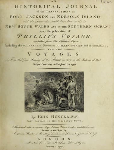
An Historical Journal of the Transactions at Port Jackson and Norfolk IslandHunter, John
History
An Historical Journal of the Transactions at Port Jackson and Norfolk Island
Hunter, John
New South Wales -- History -- Sources
At two o'clock in the morning, the wind veered round to
south-by-west, and moderated, but a heavy sea was still running.
At noon, the latitude was 32 deg. 22' south, 154 deg. 11' east
longitude. In the evening, a flying-fish flew on board, which is
rather an extraordinary event in this latitude. At day-break in
the morning of the 18th, land was discovered bearing
east-south-east; and, from its appearance, we judged it to be two
small rocks or islands, not more than six leagues distant. At the
time we first saw the land, we were standing to the northward,
with the wind at east-south-east: at eight in the morning, we
tacked towards the land, but the wind being light during the
whole day, our progress was very slow.
Early the next morning, having neared the land considerably,
we perceived a pointed rock right a-head, at some distance from
the island; on which, we hove to, and soundings were tried for
with 120 fathoms of line, but we got no bottom. At day-light we
made sail, and perceived that the two islands or hills we had
seen the day before, were two very high rocky mountains, on the
south side of an island, extending from north 37 deg. east, to
north 55 deg. east. This side of the island formed a deep bay, in
which there appeared to be good shelter from the north-east. At
noon, we had a very good meridian altitude, by which the latitude
was 31 deg. 40' south, and the center of the island bore north
40 deg. west, distant about six miles; consequently, its latitude
is 31 deg. 35' south, and the longitude 159 deg. east of
Greenwich.
The form of the island is a crescent, and it is very small in
proportion to the two stupendous rocky mountains which rise at
its southern extremity. One of the rocks rises perpendicularly
from the sea, and has the appearance of a regular pyramid, when
seen from the westward: we sailed from it in a direct course 22
leagues, and could then see it very plainly. Lieutenant Ball, who
was certainly the discoverer of this island, has named its points
and rocks, as they are marked in the chart*. At noon on the
20th, we lost fight of Ball's pyramid in the haze, after having
run 22 leagues from it in the direction of east by south: I
think, in clear weather, it may be seen at the distance of thirty
leagues. We had light winds and pleasant weather until the 24th,
when we had very strong gales from east-south-east, with a high
cross sea.
[* For this Chart, and a View of Ball's Pyramid, with
a full Description, see Phillip's Voyage, 4to.
Edition.]
Public-domain text, read in full here on John Shaqi.
Reviews
Reviews
No reviews yet
Be the first to share your thoughts on this work.
Elsewhere in the archive
Join the Discussion
Join the discussion
Sign in to leave a comment or review.
Sign InorCreate an account