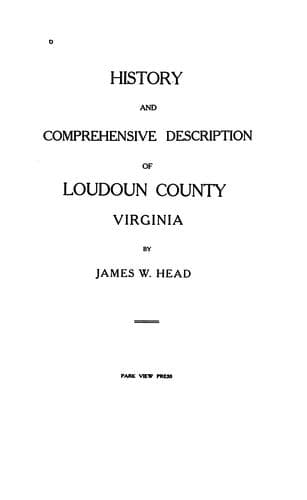
History and Comprehensive Description of Loudoun County, Virginia — John Shaqi
History and Comprehensive Description of Loudoun County, VirginiaHead, James William
History
History and Comprehensive Description of Loudoun County, Virginia
Head, James William
Loudoun County (Va.) -- History
Loudoun County is preeminently a diversified region; its surface
bearing many marked peculiarities, many grand distinctive features.
The broken ranges of hills and mountains, abounding in Piedmont
Virginia, here present themselves in softly rounded outline, gradually
sinking down into the plains, giving great diversity and
picturesqueness to the landscape. They are remarkable for their
parallelism, regularity, rectilineal direction and evenness of
outline, and constitute what is by far the most conspicuous feature in
the topography of Loudoun. Neither snow-capped nor barren, they are
clothed with vegetation from base to summit and afford fine range and
pasturage for sheep and cattle.
The main valleys are longitudinal and those running transversely few
and comparatively unimportant.
The far-famed Loudoun valley, reposing peacefully between the Blue
Ridge and Catoctin mountains, presents all the many varied topographic
aspects peculiar to a territory abounding in foothills.
The Blue Ridge, the southeasternmost range of the Alleghanies or
Appalachian System presents here that uniformity and general
appearance which characterizes it throughout the State, having gaps
or depressions every eight or ten miles, through which the public
roads pass. The most important of these are the Potomac Gap at 500
feet and Snickers and Ashby's Gap, both at 1,100 feet. The altitude of
this range in Loudoun varies from 1,000 to 1,600 feet above
tide-water, and from 300 to 900 feet above the adjacent country. It
falls from 1,100 to 1,000 feet in 4 miles south of the river, and
then, rising sharply to 1,600 feet, continues at the higher series of
elevations. The Blue Ridge borders the county on the west, its course
being about south southwest, or nearly parallel with the Atlantic
Coast-line, and divides Loudoun from Clarke County, Virginia, and
Jefferson County, West Virginia, the line running along the summit.
Of nearly equal height and similar features are the Short Hills,
another range commencing at the Potomac River about four miles below
Harpers Ferry and extending parallel to the Blue Ridge, at a distance
of nearly four miles from summit to summit, for about twelve miles
into the County, where it is broken by a branch of Catoctin Creek.
Beyond this stream it immediately rises again and extends about three
miles further, at which point it abruptly terminates.
A third range, called "Catoctin Mountain," has its inception in
Pennsylvania, traverses Maryland, is interrupted by the Potomac,
reappears in Virginia at the river margin, opposite Point of Rocks,
and extends through Loudoun County for a distance of twenty or more
miles, when it is again interrupted.
Elevations on Catoctin Mountain progressively diminish southward from
the Potomac River to Aldie, although the rocks remain the same, and
the Tertiary drainage, which might be supposed to determine their
elevations, becomes less effective in that direction.
Public-domain text, read in full here on John Shaqi.
Reviews
Reviews
No reviews yet
Be the first to share your thoughts on this work.
Join the Discussion
Join the discussion
Sign in to leave a comment or review.
Sign InorCreate an account