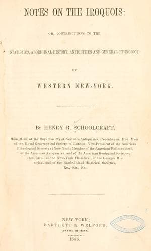
Notes on the Iroquois: or, Contributions to the Statistics, Aboriginal History, Antiquities and General Ethnology of Western New-YorkSchoolcraft, Henry Rowe
History
Notes on the Iroquois: or, Contributions to the Statistics, Aboriginal History, Antiquities and General Ethnology of Western New-York
Schoolcraft, Henry Rowe
Indians of North America -- New York (State); Iroquois Indians
The field for this species of observation is so large and attractive to
the antiquarian, that far more time than was at my command, would be
required to cultivate it. Early in the present year, Mr. Joshua V. V.
Clark visited some of the principal scenes mentioned. Subsequently, at
my suggestion and solicitation, he re-visited the same localities and
extended his inquiries to others of an interesting character, in the
county of Onondaga, descriptions of which are presented under letter
[C] of the documentary appendix.
[_d._] Ancient fortification of Osco,[64] at Auburn, Cayuga County.
[64] This ancient name for the site of Auburn, was communicated to me
by the intelligent Onondaga Taht-kaht-ons, or Abraham Le Fort. It is
descriptive of the ford or crossing place, which anciently existed
above the falls, near the site of the present turnpike bridge. This
was crossed by stepping stones, &c. The barks, which made a part of a
rude Indian bridge, were, at the time the name was bestowed, nearly
overflowed; the crossing was very dangerous, as it was just above the
brink of the falls, and it was an act of daring to pass over. The name
bestowed at this time became perpetual, although there may have been
but little danger in crossing afterwards.
The eminence called “Fort Hill,” in the southwestern skirts of the
village of Auburn, has attracted notice from the earliest times. Its
height is such as to render it a very commanding spot, and crowned,
as it was, with a pentagessimal work, earthen ramparts and palisades
of entire efficacy against Indian missiles, it must have been an
impregnable stronghold during the periods of their early intestine
wars. The following diagram, drawn by James H. Bostwick, surveyor, and
obligingly furnished by S. A. Goodwin, Esq. exhibits its dimensions:
[Illustration]
The site of this work is the highest land in the vicinity, and a visit
to it affords one of the best and most varied views of the valley of
the Owasco, and the thriving and beautiful inland town of Auburn, with
its public buildings, prison,[65] and other noted public edifices. The
ellipsis enclosed by the embankments, with their intervening spaces,
has a circumference of 1200 feet. Its minor dimensions are as follows,
namely:
[65] One of the most striking evidences of that tendency of the surface
limestone stratification of western New-York to assume a fissured
character, marked by the cardinal points, is seen in the banks of the
Owasco, a short distance below the State prison.
From A. to M., 310 feet.
“ B. to L., 416 “
Opening at A., 166 “
“ B., 66 “
“ C., 78 “
“ D., 60 “
“ E., 50 “
Wall at F., 275 “
“ G., 145 “
“ H., 278 “
“ I., 52 “
“ K., 30 “
Public-domain text, read in full here on John Shaqi.
Reviews
Reviews
No reviews yet
Be the first to share your thoughts on this work.
Elsewhere in the archive
Join the Discussion
Join the discussion
Sign in to leave a comment or review.
Sign InorCreate an account