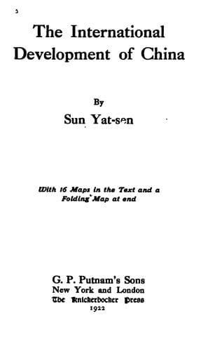
The International Development of ChinaSun, Yat-sen
History
The International Development of China
Sun, Yat-sen
China -- Economic conditions -- 1912-1949; Railroads -- China
j. The Lanchow-Chungking Line
This line starts from Lanchow southwestward and follows the same route
as line (a) as far as Titao. Thence, it branches off and ascends the
Taoho Valley across the Minshan watershed into the Heishui Valley
following it down to Kiaichow and Pikow. After Pikow, it crosses the
Kansu border into Szechwan and proceeds to Chaohwa, where the Heishuiho
joins the Kialing. From Chaohwa, it follows the course of the Kialing
River down to Paoning, Shunking, Hochow, and Chungking. The line is
about 600 miles long, running through a very productive and rich
mineral land.
k. The Ansichow-Iden line
This line passes through the fertile belt of land between the Gobi
Desert and the Altyntagh Mountain. Although this strip of land is
well watered by numerous mountain streams yet it is very sparsely
populated, owing to the lack of means of communication. When this line
is completed, this strip of land will be most valuable to Chinese
colonists. The line starts from Ansichow westward to Tunhwang, and
skirts the southern edge of the Lobnor Swamp to Chochiang. From
Chochiang, it proceeds in the same direction via Cherchen to Iden where
it connects with the terminus of the Northwestern System. With this
System, it forms a continuous and direct line from the Great Eastern
Port to Kashgar at the extreme west end of China. This line from
Ansichow to Iden is about 800 miles in length.
l. The Chochiang-Koria Line
This line runs across the desert alongside the lower part of the Tarim
River. The land on both sides of the line is well watered and will be
valuable for colonization as soon as the railroad is completed. This
line is about 250 miles in length and connects with the line that
runs along the northern edge of the desert. It is a short cut between
fertile lands on the two sides of the desert.
m. The Great Northern Port-Hami Line
This line runs from the Great Northern Port in a northwesterly
direction by way of Paoti and Siangho to Peking. From Peking it
runs on the same track with the Peking-Kalgan Railway to Kalgan,
where it ascends the Mongolian Plateau. Then it follows the caravan
road northwestward to Chintai, Bolutai, Sessy, and Tolibulyk. From
Tolibulyk, it takes a straight line westward crossing the prairie and
desert of both the Inner and Outer Mongolia to Hami where it connects
with the Great Eastern Port-Tarbogotai line which runs almost directly
west to Urumochi, the capital of Sinkiang. Thus, it will be the direct
line from Urumochi to Peking and the Great Northern Port. This line is
about 1,500 miles in length, the greater part of which will run through
arable land and so when it is completed it will form one of the most
valuable railways for colonization.
n. The Great Northern Port-Sian Line
Public-domain text, read in full here on John Shaqi.
Reviews
Reviews
No reviews yet
Be the first to share your thoughts on this work.
Elsewhere in the archive
Join the Discussion
Join the discussion
Sign in to leave a comment or review.
Sign InorCreate an account