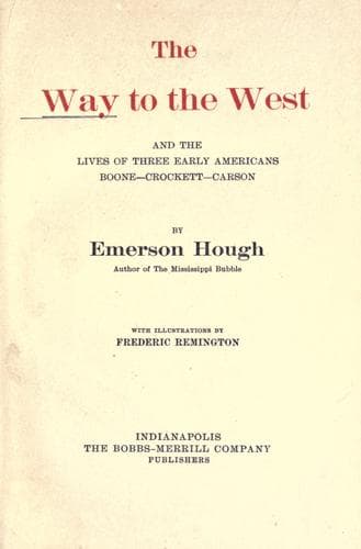
The Way to the West, and the Lives of Three Early Americans: Boone—Crockett—CarsonHough, Emerson
History
The Way to the West, and the Lives of Three Early Americans: Boone—Crockett—Carson
Hough, Emerson
Boone, Daniel, 1734-1820; Carson Kit, 1809-1868; Crockett, Davy, 1786-1836; Mississippi River Valley -- History; West (U.S.) -- History
The Oregon trail followed the South Fork for a time, then swung over to
the North Fork, at Ash Creek, five hundred and thirteen miles from
Independence. It was six hundred and sixty-seven miles to Fort Laramie,
which was the last post on the eastern side of the Rockies. Thence the
trail struggled on up the Platte, keeping close as it might to the
stream, till it reached the Ford of the Platte, well up toward the
mountains, and seven hundred and ninety-four miles out from
Independence—nearly the same distance from that point as was the city
of Santa Fé on the lower trail.
Yet a little farther on and the trail forsook the Platte and swung
across, eight hundred and seven miles out from the Missouri, to the
valley of the Sweetwater, now an essential feature of the highway. The
famous Independence Rock, eight hundred and thirty-eight miles from
Independence, was one of the most noteworthy features along the trail.
It marked the entrance into the Sweetwater district, and was a sort of
register of the wilderness, holding the rudely carved names of many of
the greatest Western venturers, as well as many of no consequence. The
Sweetwater takes us below the foot of the Bighorns, through the Devil’s
Gate, and leads us gently up to that remarkable crossing of the Rockies
known as the South Pass, a spot of great associations. This is nine
hundred and forty-seven miles from the Missouri River. Here all the
west-bound voyagers felt that their journey to the Pacific was well-nigh
completed, though as a matter of fact it was not yet half done. This
Western geography, of which most of us know so little, was a tremendous
thing in the times before the railways came.
Starting now down the Pacific side of the Great Divide, the traveler
passed over a hundred and twenty-five miles of somewhat forbidding
country, crossing the Green River before he came to Fort Bridger, the
first resting point west of the Rockies, ten hundred and seventy miles
from the Missouri. This was a delightful spot in every way, and the
station was always welcomed by the travelers. The Bear River was eleven
hundred and thirty-six miles from Independence, and to the Soda Springs,
on the big bend of the Bear, was twelve hundred and six miles. Thence
one crossed over the height of land between the Bear and the Port Neuf
rivers, the latter being Columbia water; and, at a distance of twelve
hundred and eighty-eight miles from Independence, reached the very
important point of Fort Hall, the post established and abandoned by the
Easterner, Nathaniel Wyeth. This was the first point at which the trail
struck the Snake River, that great lower arm of the Columbia, which came
dropping down from its source opposite the headwaters of the Missouri,
as though especially to point out the way to travelers, just as the
South Fork of the Platte led to the Spanish Southwest. There lay our
pathways, waiting ready for us!
Public-domain text, read in full here on John Shaqi.
Reviews
Reviews
No reviews yet
Be the first to share your thoughts on this work.
Elsewhere in the archive
Join the Discussion
Join the discussion
Sign in to leave a comment or review.
Sign InorCreate an account